

Welcome back readers!
I’ve missed you all, and sorry for being AWOL for so long. Writers block and life getting busy and all. I’ve decided to to try some shorter posts on my blog for now, and these short posts will form a coherent series together. Despite the posts being shorter, I’m undertaking a massive project of pedestrianism that is sure to take a year or more to complete.
I’ve been a nerd about geography for a lot of my life, and one of my recent fascinations has been the neighborhoods of Minneapolis, the city in which I currently live. After familiarizing myself with a map of the city and memorizing the names of neighborhoods, I found myself interested in in the names of the streets along the grid layout of the city. Odonymy, or the study of street names, was something I got into when doing research for my Montréal Metro blog post, since so many of the station names there are based on the nearby street. Like many American cities, the majority of Minneapolis is on a north-south grid, with the notable exception of the slanted downtown area built parallel to the Mississippi River that was constructed and planned before the rest of the standard grid.
At first, my plan was to simply make a list of all the streets and roads in Minneapolis, because I like making lists and categorizing things so much. This turned out to be a fool’s errand however. The seemingly endless amount of small alcoves, winding boulevards, and minuscule inlets made listing and categorizing every single street impossible. So instead of that, I thought of a new plan. I am going to walk all the way down every single in the city limits, over the course of many installments! Of course, I have to set some limitations for myself. I can’t walk on highways without sidewalks, so I-35W, 94, 394, 494, and 55 are excluded from my trek. I also can’t trespass on private property. I won’t be walking through the many miles of unnamed alleyways in the city either. Lastly, I’m excluding footpaths in public parks, because I arbitrarily decided not to count those. Every time I go on a small walk, I’ll update this blog and provide a visual representation of what I did to add to my walking, noting where I walked and what I saw.
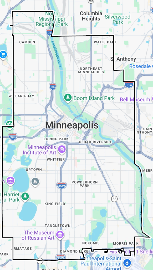
I started off by making a custom map in Google maps with the borders of the city to indicate where I need to walk, where I have been, and where I have not been. In our first update, I went on a small walk to the gym and back today, which added the following paths on my map:
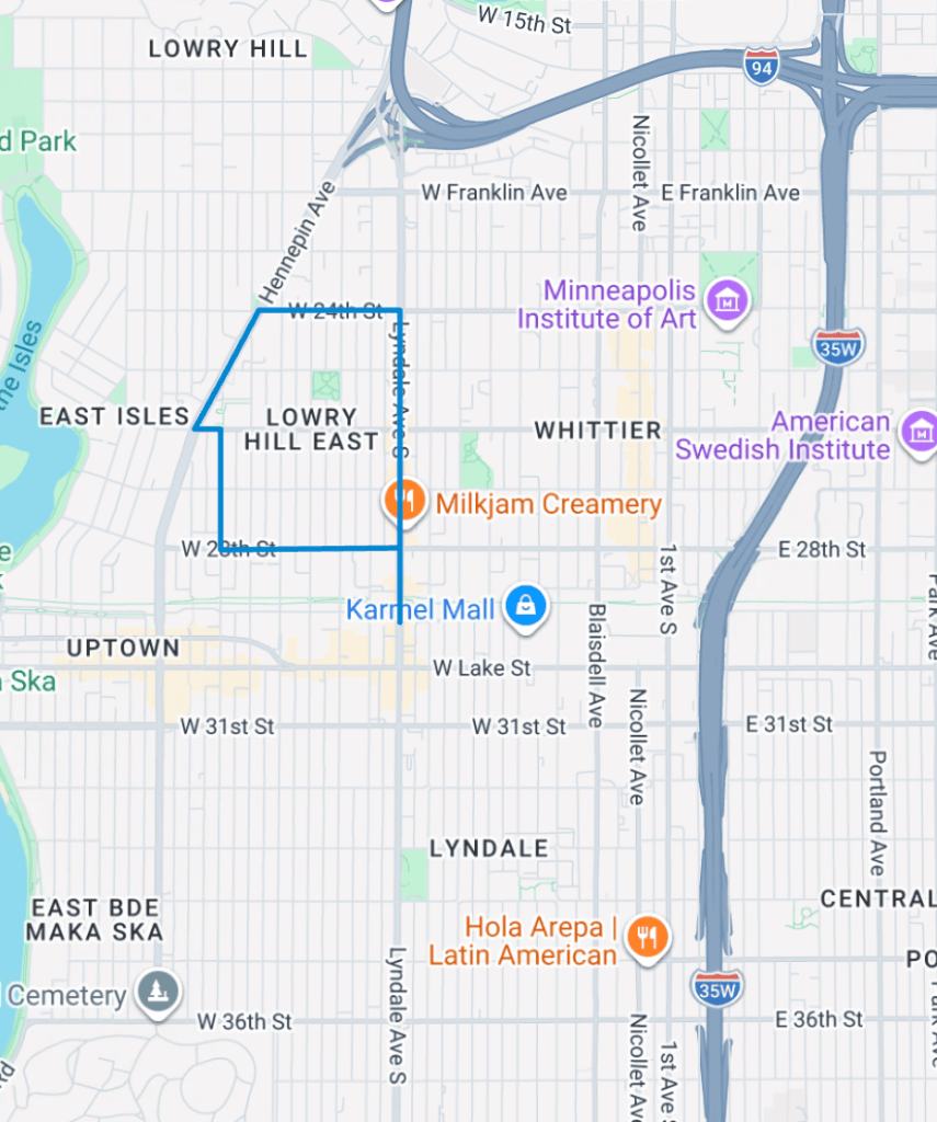
A very small area in the grand scheme of things but we have to start somewhere! I look forward to updating everyone on my amazing journey of walking.
With digital gratitudes and free of platitudes,
Isaiah


Leave a Reply